Home
Wall Map: National Parks Of The United States, Tubed
ROCK CREEK
Wall Map: National Parks Of The United States, Tubed
From National Geographic Maps
Current price: $24.95
ROCK CREEK
Wall Map: National Parks Of The United States, Tubed
From National Geographic Maps
Current price: $24.95
Loading Inventory...
Color: Default Title
Size: One Size
Loading Inventory...
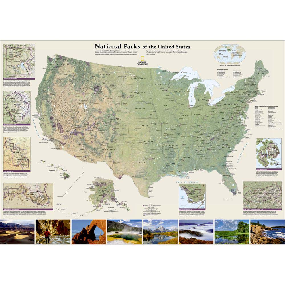
The National Geographic Wall Map: National Parks of the United States highlights the nearly 400 magnificent parks across America. The country is represented in subtle earth-tones with shaded mountain relief and intricately drawn river systems. Colorful photos capture some of the diverse landscapes preserved and protected by the national park system. Separate inset maps provide detail and descriptions of seven of the parks: Yellowstone, Yosemite, Acadia, Grand Canyon, Great Smoky Mountains, Everglades, and Zion. Parks located in U.S. territories are included on an inset world map.About National Parks of the United States Since the establishment of Yellowstone in 1872, the United States has worked to preserve and protect the most unusual, beautiful, and peaceful corners of the country. These national treasures evoke wonder, exhilaration, inspiration, and connection with the spirit of a diverse and unique nation. Whether it was established for its natural beauty or historical significance, these parks represent the distinct landscapes of the country from stunning mountain vistas, breathtaking canyons, and red rock arches to dense wetlands, scenic rivers, and coral reefs.Details:
Dimensions: 30" x 42"
Scale: 1:4,500,00
2011
About National Geographic Maps:National Geographic is a renowned authority in cartography. For over 120 years the Society's maps have helped spread geographic knowledge around the globe. A vast database allows National Geographic to combine the latest data gained by space-age technology with innovative digital mapping techniques to create state-of-the-art political, physical, and thematic maps. The Society's meticulous research and attention to detail have established a standard of achievement that is unparalleled.
![Yellowstone National Park [Map Pack Bundle]](https://cdn.mall.adeptmind.ai/https%3A%2F%2Fwww.rockcreekoutfitters.com%2Fcdn%2Fshop%2Fproducts%2FYellowstone-National-Park-Map-Pack-Bundle-TI01020579_N_20A.jpg_medium.webp)