Home
Walking The Brittany Coast Path: GR34 from Mont-Saint-Michel to Roscoff
Barnes and Noble
Loading Inventory...

Walking The Brittany Coast Path: GR34 from Mont-Saint-Michel to Roscoff in Chattanooga, TN
Current price: $27.95
Barnes and Noble
Walking The Brittany Coast Path: GR34 from Mont-Saint-Michel to Roscoff in Chattanooga, TN
Current price: $27.95
Loading Inventory...
Size: Paperback
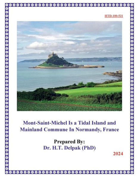
A guidebook to walking a 624km (388 mile) section of France’s GR34 Brittany Coast Path, also known as the Sentier des Douaniers (Customs Officers’ Path), from Mont-Saint-Michel to Roscoff. Suitable for any moderately fit walker, the trail can be hiked in around a month.
The route is described from east to west in 28 stages of between 13 and 33km (8–20 miles). Also included are suggestions for four 5-day itineraries taking in some of the highlights, for the benefit of those who require or would prefer a shorter trip.
GPX files
available to download
1:100,000 maps
included for each stage plus larger-scale town maps for key locations
Handy
route summary tables
and
accommodation listings
help you plan your itinerary
Refreshment, accommodation and public transport
information given for each trek stage
Advice on
planning and preparation