Home
C-Map Reveal Chesapeake Bay To The Bahamas
Academy Sports + Outdoors
C-Map Reveal Chesapeake Bay To The Bahamas
From C-Map
Current price: $249.99

Academy Sports + Outdoors
C-Map Reveal Chesapeake Bay To The Bahamas
From C-Map
Current price: $249.99
Loading Inventory...
Loading Inventory...
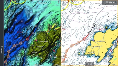
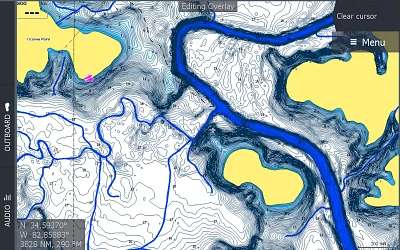
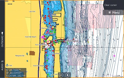
Navigate your way through open water with ease when you use the C-Map Reveal Chesapeake Bay To The Bahamas. This map is compatible with Lowrance, Simrad and B&G Chartplotters and contains coastal maps from Chesapeake Bay to the Bahamas. The data provides vector charts, dynamic raster charts, satellite overlays, tide and current imaging and Marina Port Plans. The Shaded Relief offers custom depth shading for enhanced views of the seafloor, while the Custom and Easy Routing utilizes chart data and your personalized vessel information to create safe routes. Micro SD card format.
- Contains coastal maps from Chesapeake Bay to the Bahamas
- Delivers up to 3,000 waypoints, 100 routes, 100 trails with up to 10,000 points per trail
- Vector charts, Dynamic raster charts, satellite overlay and aerial photos provide detailed information about tides, currents and Marina Port Plans
- Hi-Res bathymetry
- Comes with subscription free routing
- Compatible with Lowrance, Simrad and B&G Chartplotters